File:The Pirate Isles.png: Difference between revisions
From FeyworldWiki
Jump to navigationJump to search
(uploaded a new version of "File:The Pirate Isles.png": Map of the Pirate Isles near the continent of Duria) |
No edit summary |
||
| Line 1: | Line 1: | ||
A map of the Pirate Isles on the continent of Duria | A map of the Pirate Isles on the continent of Duria | ||
<noinclude>[[Category:Geography]][[Category:Duria]][[Category:Maps]]</noinclude> | |||
Latest revision as of 11:31, 23 July 2014
A map of the Pirate Isles on the continent of Duria
File history
Click on a date/time to view the file as it appeared at that time.
| Date/Time | Thumbnail | Dimensions | User | Comment | |
|---|---|---|---|---|---|
| current | 07:27, 2 January 2010 | 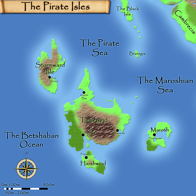 | 800 × 800 (413 KB) | WikiSysop (talk | contribs) | Map of the Pirate Isles near the continent of Duria |
| 05:01, 2 January 2010 | 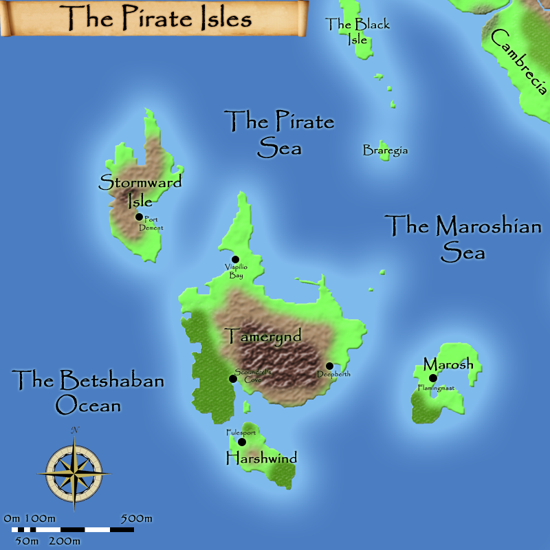 | 800 × 800 (412 KB) | WikiSysop (talk | contribs) | A map of the Pirate Isles near the continent of Duria | |
| 17:23, 31 December 2009 | 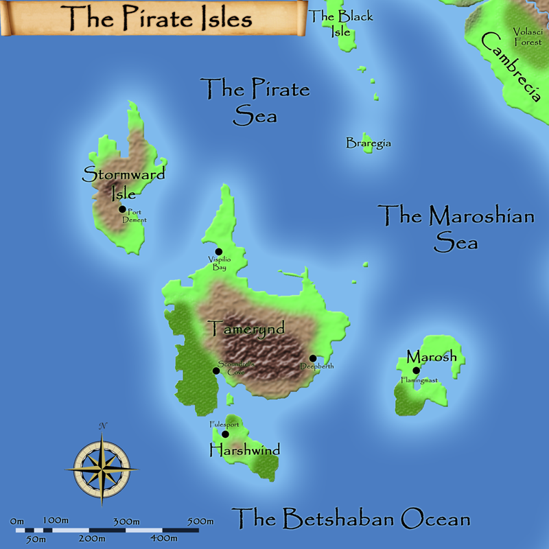 | 800 × 800 (437 KB) | WikiSysop (talk | contribs) | A map of the Pirate Isles on the continent of Duria |
You cannot overwrite this file.
File usage
There are no pages that use this file.